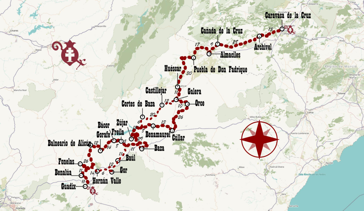
Main Route
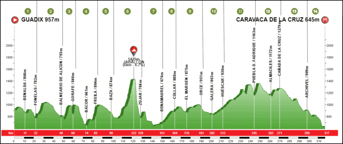
Stage 1. GUADIX - FONELAS
Stage 2. FONELAS - BALNEARIO DE ALICÚN
Stage 3. BALNEARIO DE ALICÚN - GORAFE
Stage 4. GORAFE - FREILA
Stage 5. FREILA - BAZA
Stage 6. BAZA - ZÚJAR
Stage 7. ZÚJAR - BENAMAUREL
Stage 8. BENAMAUREL - CÚLLAR
Stage 9. CULLAR - ORCE
Stage 10. ORCE - HUÉSCAR
Stage 11. HUÉSCAR - PUEBLA D. FADRIQUE
Stage 12. PUEBLA D. FADRIQUE - CAÑADA DE LA CRUZ
Stage 13. CAÑADA DE LA CRUZ - ARCHIVEL
Stage 14. ARCHIVEL - CARAVACA DE LA CRUZ
Road map
Technical details of the route
Distance = 318 km
14 stages of 23 km on average and 310 m elevation gain.
>51% of trails (GR, PR, SL)
75% of Country roads and paths
Less than 25% asphalt and by roads with very little traffic
Tour 99.7% cycleable
Downloads
Southern Spiritual Trail through the Granada Geopark
An essential work for gaining an in-depth understanding of what the Southern Spiritual Way has to offer, and for organising our journey thanks to countless practical details such as accommodation and services available along the way.